The city seen from above: a whole Moldovan town on one wall
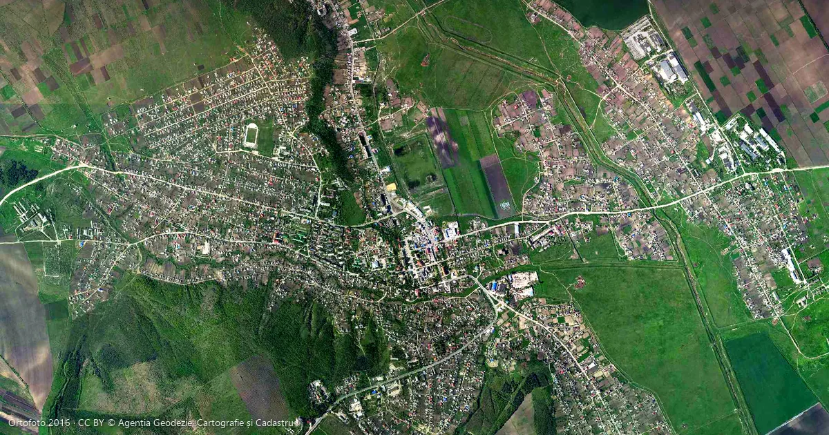
A village fits easily on a poster: one or two kilometres across, with every house easy to see. A town runs four to six kilometres from edge to edge, with a centre, a station, an industrial area and new districts on its outskirts. In recent weeks, several people who wrote to us asked for their town rather than their village. It can be done, and here is what to know first.
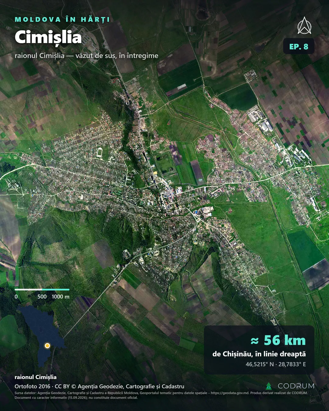
Cimișlia seen from above, whole, in the screen frame published in the series “Satul tău, văzut de sus”. Orthophoto 2016 © Agenția Geodezie, Cartografie și Cadastru, CC BY.
A town is not a bigger village
The difference is measured in millimetres. On the poster of a small village, a house is about two millimetres wide. When a town five or six kilometres across fits on a 50 × 70 cm poster, a house is about one millimetre: still visible as a dot, on a street you can follow with your finger. From two metres away you read the main streets, the blocks, the school yards, the stadium, the station and the river. A village is read house by house, a town district by district.
That is why we recommend at least 50 × 70 cm for a town. For a large wall, we also make 60 × 90 cm on request. For large sizes, you can also have the poster personalised and choose the frame with us. The 60 × 90 cm size does not fit in a courier parcel, so it is handed over in person or collected in Chișinău. For Chișinău itself, too large for a single readable poster, we suggest one sector or district rather than the whole city.
How to read a town from above
- Water. River, lake, ponds. Towns grew up beside water, and it gives you your bearings.
- The centre. Where the roads meet, with larger, denser roofs around the market, the town hall and the church.
- The railway. The only line with no sharp corners. Near the station, the tracks multiply beside long warehouses.
- The industrial area. Large, light roofs in rows, on the edge of town, often near the railway.
- Apartment blocks. Long rectangles in rows. The longer the shadow, the taller the block.
- New districts. Straight streets laid out before the houses, some plots still empty.
- Roads out of town. The town ends where fields, orchards and woods begin.
North is at the top. The north arrow and the scale bar let you measure distances right on the wall.
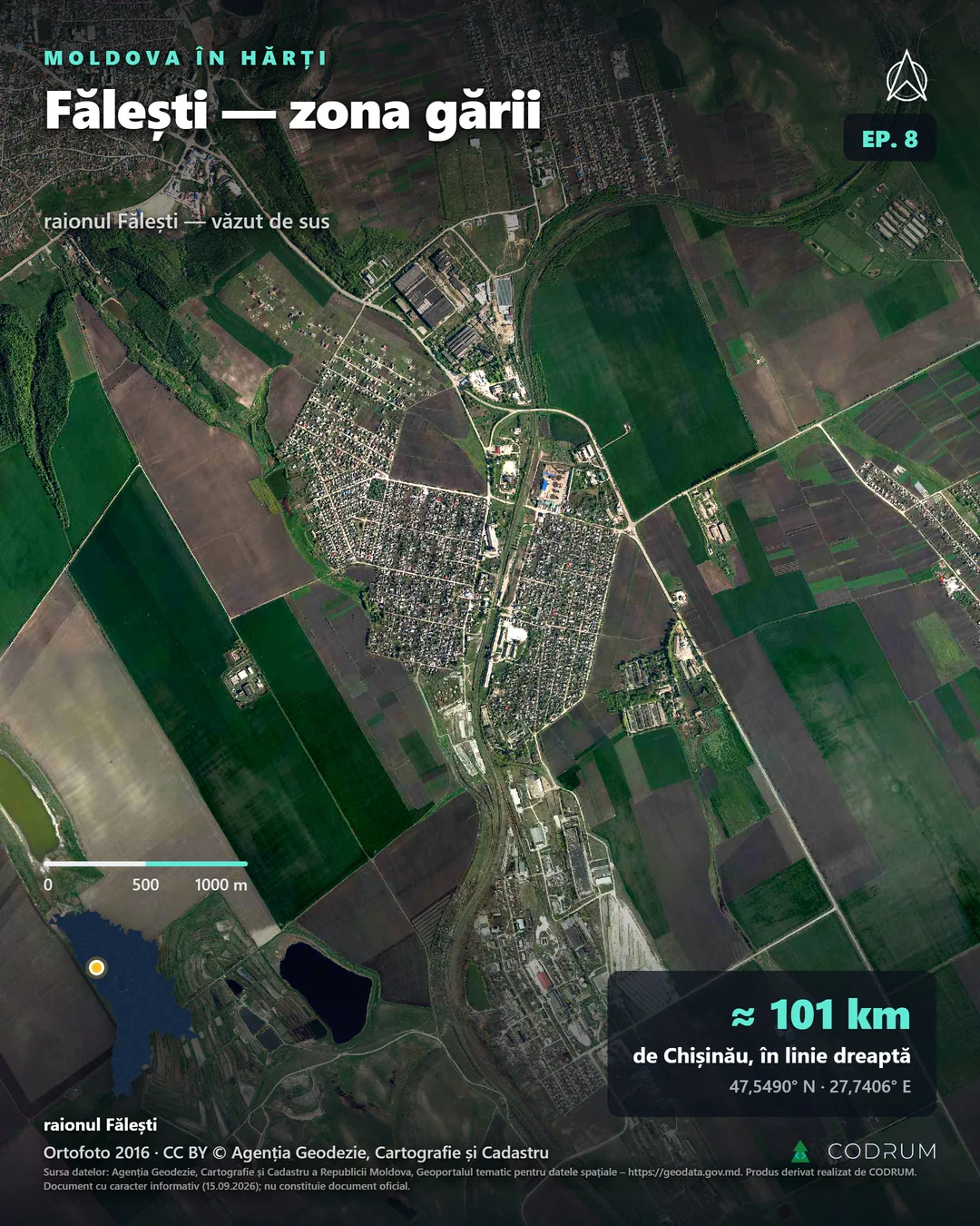
Fălești, station district: the railway runs through the middle, large buildings line it, and the straight streets of the district read from a distance. Orthophoto 2016 © Agenția Geodezie, Cartografie și Cadastru, CC BY.
What is on the poster
At the top, on short lines: the name of the town and “văzut de sus, în întregime” (seen from above, whole). At the bottom: the scale bar, a small map of Moldova locating the town, the straight-line distance to Chișinău and the coordinates. There is also a north arrow, a small QR code and the source: the Agency for Geodesy, Cartography and Cadastre, the year of the flight and the CC BY licence. Street names are not printed: this is an aerial map poster, not a street plan.
One rule applies to every poster: no text sits on top of houses. Labels go on fields, water or woods, and if the top corner is built up, the title moves to the right. For a town hall, a school or a museum, we mark the building with its name and, when a verified source exists, the year of the locality’s first documentary record.
Where it goes
In an office, a town on the wall says where you work without a word. Clients walk up and find their street. For a construction, transport or property firm, it is also a working tool: it shows what had been built by the date of the flight. In a meeting room, the 60 × 90 cm size lets you discuss a route or a district with a hand on the map.
In a town hall, the map shows the whole town at a glance. In a school, pupils find their block, then the way to school, then the river. A poster stays a fixed image, though. A town hall that needs a map it can keep up to date, with streets, networks or heritage, needs an interactive map.
Many people who grew up in a Moldovan town now live abroad: our country-by-country table counts at least 1.45 million people born in Moldova living in other countries. You can order from anywhere, by card and in euros, for an address in Moldova.
What the official orthophoto is, and what it is not
It is not a screenshot from a mapping app. It is the official orthophoto of the Republic of Moldova, published by the Agency for Geodesy, Cartography and Cadastre on geodata.gov.md under a CC BY licence: aerial photographs corrected so that the scale is the same everywhere, as on a map.
Three flights cover the country: 2020 for the centre, 2021 for the south and 2016 for the north. We use the flight that shows the town whole, and the year is printed on the poster. Anything built after the flight is missing, and the poster has no legal or cadastral value. Localities on the left bank of the Dniester are not covered, so we cannot make posters for them. Near the border, the image stops at the frontier and leaves a white band, which we point out before printing.
Whole towns seen from above are already in our archive of published localities, such as Cimișlia or the station district of Fălești.
How to order
You can already order online. On the order page, prices are in euros. Choose the size, the district and the town, then leave a phone number and an email. A free preview reaches you within 48 hours. Pay by card straight away or after the preview, and cancel at no cost until you confirm it. The poster arrives within one to two weeks. Sizes, frames and conditions are set out on the posters page.
For now, we deliver within Moldova. For delivery to another country, write to us at contact@codrum.fr or through the contact form.
Order the poster of your town, or see the sizes and the version for institutions.
Sources: orthophoto © Agenția Geodezie, Cartografie și Cadastru, flights 2016, 2020 and 2021, CC BY licence, geodata.gov.md · images: screen frames from the series “Satul tău, văzut de sus”, derived products made by CODRUM. Informative document, not an official document.
Questions fréquentes
Can the villages of the municipality be included?
A municipality often includes villages several kilometres from the town. Including them widens the frame and shrinks the town on paper. The town alone, with the village on a separate poster, often works better.Can you zoom in on the centre?
Then the outer districts leave the frame and the poster no longer shows the whole town. For more detail, choose a larger size.Do you deliver outside Moldova?
For now, we deliver within Moldova. From abroad, you can order for an address in Moldova. For delivery to another country, write to us at contact@codrum.fr or through the contact form.
Articles liés
Freelance Web Developer in Morsang-sur-Orge and Essonne (91)
Why pick a local freelancer over a Paris agency, services for SMEs in Essonne, towns covered, 2026 projects and transparent pricing.
Building an SME Marketing Site with React + Vite: 2026 Standards
Why React + Vite + SSG beats WordPress on performance, security and hosting cost, with two case studies: Clad-Primeco and Milena Glow Up.